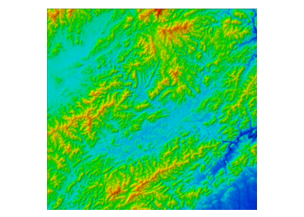
Digital Elevation Model(DEM) production
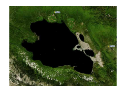
Digital Orthophoto Map(DOM) production
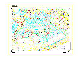
Digital Line drawing(DLG) production
Digital raster graphic(DRG) production
Land changes investigation and remote sensing monitoring
Remote sensing data processing
Investigation and monitoring of surface water resources
Water environment monitoring, water conservancy project monitoring, illegal construction monitoring and investigation, etc.
Remote sensing monitoring project of FAST electromagnetic wave quiet area radio facilities and construction
Surveying of Land Changes Investigation and Remote Sensing Monitoring in Tongliao City in 2018 (In-house work)
Aerial Photogrammetry Project of Langfang Urban-rural Planning Bureau Sub-item 1: 500DLG Production
DOM Production of Registration and Certification Project for Rural Land Contracting Management Right in Yongdeng County
3D Data Modeling Technology Service Project of Changji Inclined Photography